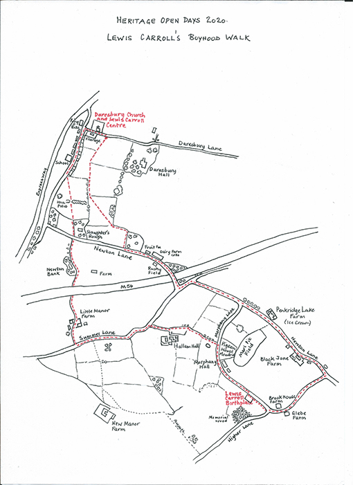
Heritage Open Days 2020 - Hidden Nature Lewis Carroll’s Boyhood Walk
Lewis Carroll’s Boyhood Walk
Please download the map here
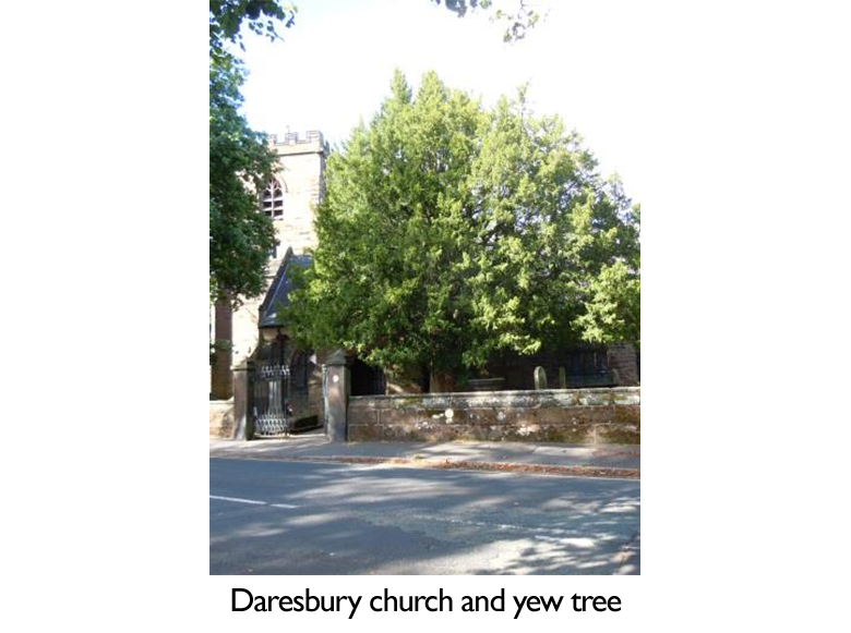
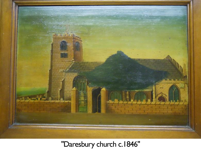 The directions given are for an anti-clockwise walk, but you can reverse the route, if you wish. As you begin the walk take a look at the Yew tree which stands by the porch to the church. It appears in a painting from the 1840s, and Lewis Carroll would have passed it every time he went into church with his family. Perhaps this is the tree mentioned in the churchwarden’s accounts from the 1680s
‘Paid to the sexton to remove a young yew tree from the steeple and set it in the churchyard – 1/- (one shilling)’. If so, it is well over three hundred years old.
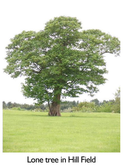
From the gate, turn right towards the Ring o’ Bells. At the junction, turn left and walk up the village street, (the route of an old Roman road), until you come to the school with its ‘Alice’ weathervane, and then you will see the sign for the Lewis Carroll Walk, on your left. Enter the field, called Hill Field in the old tithe map, and follow a diagonal path towards a gate in the hedge. On your right, on a raised mound topped by a single tree, is the site, according to some local historians, of the stronghold or ‘burgh’ of an Anglo Saxon chieftain named ‘Deor’, the origin of the name Daresbury.
 Follow the path across a second field, and a third, where horses are usually grazing, down to the gate, and come out onto the lane. Opposite is a narrow lane signed Newton Bank. Walk along, until you see a finger post sign on the right for a bridleway. This will take you under the M56 to a farm track and through Little Manor Farm yard onto Summer Lane.
When Lewis Carroll was a boy, George and Ellen Brereton lived at this farm with their young family. The farm was part of the estate belonging to the Heron family of Daresbury Hall, and Moore Hall. The Reverend George Heron, baptised the infant Lewis Carroll, with the names Charles Lutwidge, at Daresbury church in July 1832. Fourteen years later, the eleventh and youngest child born to the Rev. Dodgson and his wife was baptised Edwin Heron, perhaps as a memento of their Daresbury days.
Turn left on the lane and continue until you see the entrance to Hallam Hall on the right. Take this route and as you come close to the buildings, follow the footpath through the kissing gate along the field path keeping close to the hedge. Keep straight on, with the hedge on your left, after negotiating a slight dog’s leg in the route after the broken gate.
As you come out of the field onto Morphany Lane you are facing a field known as Pigeon House Meadow on the tithe map. Note how narrow the lane is.
‘Even the passing of a cart was of great interest to the children’. So wrote Stuart Collingwood, Lewis Carroll’s nephew and first biographer.
Walking down the lane, on the left are the barns, now converted to housing, and new bungalow, the
site of Morphany Hall, the nearest neighbours to the Parsonage.
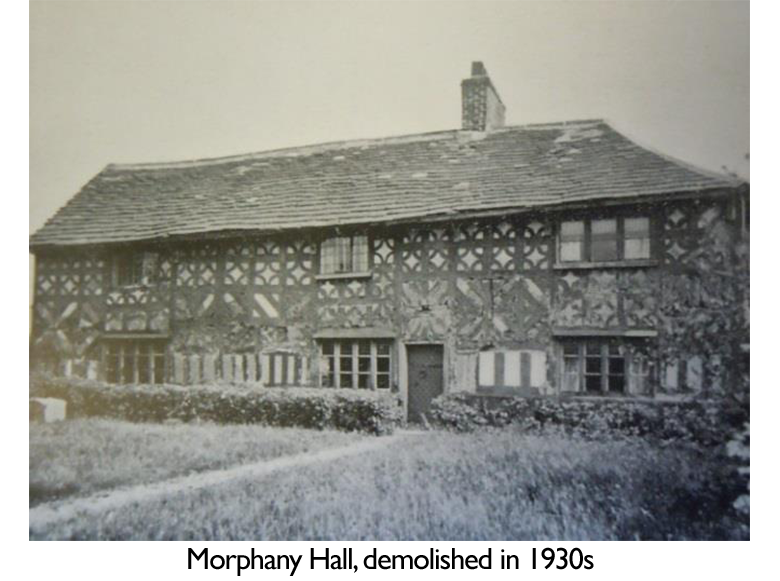 The family who lived here during Lewis Carroll’s childhood, were James and Mary Darbyshire, and their children, who were of similar ages to the Dodgson children. They were a Quaker family, with connections to Frandley Meeting House. James Darbyshire was a farmer and made Cheshire cheese too. When Lewis Carroll’s mother was visiting her parents in Hull she wrote a letter to her son, Charley, and sent her best love to ‘Aunt Dar’. Did she mean Mary Darbyshire? 4
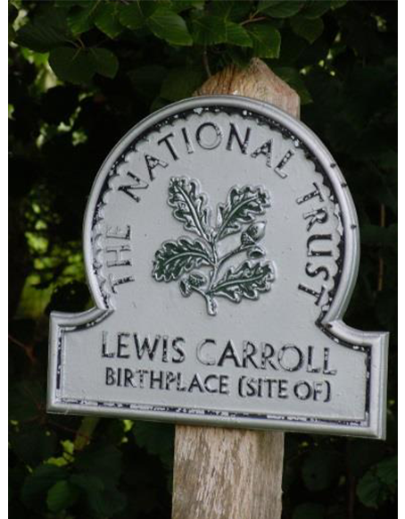
As you walk down the lane you will see on the right, the site of the Parsonage where Lewis Carroll was born. You can enter here, or continue to the bottom of the lane to gain access to the site. Here youcan see the footprint of the house laid out in bricks, and the well, with its decorative iron cover depicting the dormouse in a teapot. Notice how quietly situated it is, set in farmland and surrounded by farms even today. Lewis Carroll remembered this spot fondly as he described it in a poem written when he was about 27 years old.
From ‘Faces in the Fire’,
‘I watch the drowsy night expire,
And Fancy paints at my desire,
Her magic pictures in the fire.
An island farm, ‘mid seas of corn,
Swayed by the wandering breath of morn,
The happy spot where I was born’………..
The house was built on glebe land, which is land belonging to the church, in 1820. It had seven bedrooms, two kitchens and pantries, a parlour, dining room, study and schoolroom. Outside were the dust hole, and ‘necessaries’ (w.c.) a stable for 2 horses, a shippon for 4 cows, and a gig house. Charles and Frances Dodgson were only the second occupants when they arrived in 1827 as a newly married couple, and the following year their first child was born. In all, seven girls and three boys were born in the house, the youngest child Edwin, was born after they moved to north Yorkshire.
In the 1841 census, the Parsonage was home to the Rev Charles Dodgson, his wife Frances and sister-in-law Lucy Lutwidge, and their family of 8 children. There were also several servants and 3 pupils of the Rev. Dodgson living there too, so it must have been quite a noisy house at times!
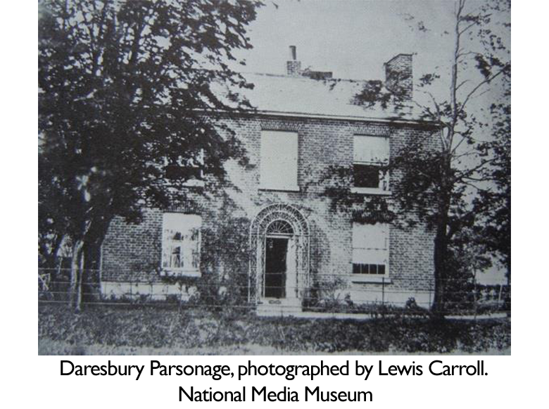 Unfortunately, the house burnt down in the 1880s, but we do know what it looked like from the photographs which Lewis Carroll himself took around 1859, when he brought his camera and developing equipment to his childhood home and took several photographs. This was three years before he told the story of Alice’s Adventures to Alice, Lorina and Edith Liddell, the daughters of the Dean of Christ Church, Oxford, where Charles Lutwidge Dodgson taught mathematics, and six years before the book was published.
His nephew, when writing about the author’s boyhood, described how he ‘made pets of the most odd and unlikely animals, and numbered certain snails and toads among his most intimate friends’ Certainly the countryside here is dotted with many ponds, and look out for the ditch bordering Morphany Lane itself, on both sides, in some places!
Leave the site at the junction with Higher Lane. (Here, you can make a detour by going right to visit the Lewis Carroll Memorial Wood. It was planted in 1998, to mark the centenary of his death). Go left, past Brook House Farm, and Glebe Farm, and take the next left onto Newton Lane. On the left you pass Black Jane Farm, with the date, 1729, on the front of the building.
This was home to William and Sarah Darbyshire and their family. William and Sarah were older than Lewis Carroll’s parents and William had been a churchwarden at All Saints, so would have known the Dodgsons well, and so it is also possible that Sarah is the ‘Aunt Dar’ referred to in Frances Dodgson’s letter to her son.
Continue along the lane until you approach Penkridge Lake Farm, on the right, (Daresbury Dairy Ice Cream made here today)
Look towards the fields opposite, one of which was known as Marl Pit Field in the 1840s. It belonged to Morphany Hall Farm, and was probably the place where the young Lewis Carroll played with friends, because Stuart Collingwood wrote how the boy loved to climb trees and scramble about in the old marl pits. If you are wondering what marl is, it’s a kind of soil particularly rich in lime, which was used as a fertiliser to spread on the fields. The marl was dug out, leaving pits which, over time, sometimes filled with water so creating ponds.
Carry on walking, past the junction with Morphany Lane, until you reach Summer Lane with the motorway beyond. Go left, and then right, to cross the bridge over the motorway. Here, at the crossroads, is the site of Newton Cross, now lost, but you may be able to see where the old road used to be before the motorway came through.
When the Reverend Dodgson and the ladies of the family made their way to church in the horse drawn gig, this would have been their route. The older children would have walked. When he was an adult, Lewis Carroll, was in the habit of taking long walks, in all weathers, perhaps it was a legacy from his Cheshire childhood!
Continue along Newton Lane, passing Dairy Farm and the one-time Daresbury Fruit Farm. A field on the left here was known as ‘Rushy Field’ on the tithe map. Stuart Collingwood tells us that when he was a young boy, Lewis Carroll would collect rushes which grew in marshy ground, and peel them, with the idea that the pith from the centre could be given to the poor! Was he thinking about rush lights which were used in country cottages in the first half of the 19th century, which involved dipping the peeled, dried rushes in fat, to make a rudimentary candle?
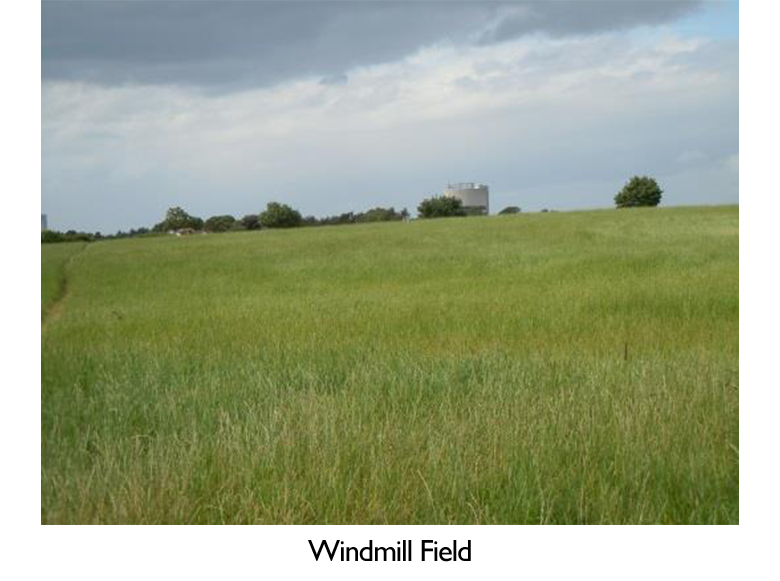 When you see a footpath on the right, enter the field and follow the path round the edge keeping the hedge on your right. Walk diagonally across the next field, known as Windmill Field on the tithe map, heading towards Daresbury village, and the tower at Daresbury Laboratories, which will be seen above the trees.
The tithe map records a windmill at Preston-on-the-Hill, situated above what is today, the motorway junction, but where the windmill referred to here, in this field, once stood, is unclear.
Carry on walking through the next gate and straight on, ignoring the option to go left, until you glimpse the church. Walk diagonally across this field, and emerge, with extreme caution (no pavement), onto Daresbury Lane at another kissing gate with the sign for the Lewis Carroll Walk next to it, and return to the church.
^ Top
